How to Predict Weather With Clouds
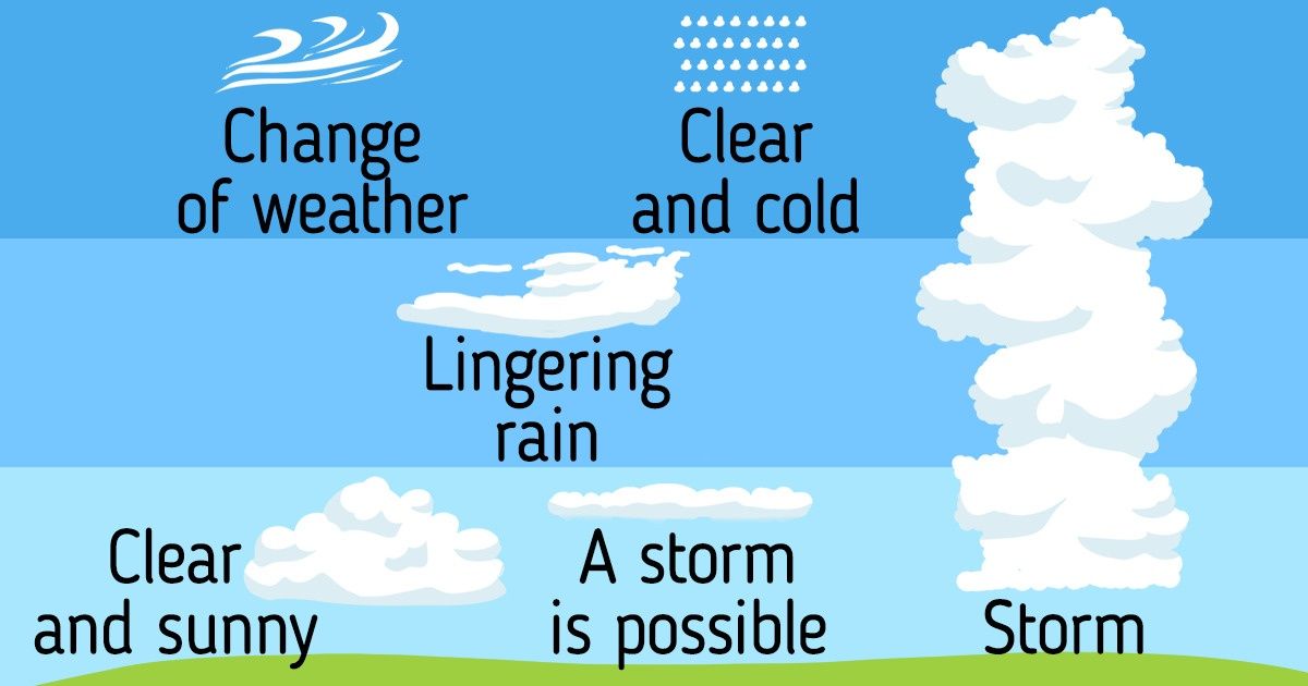
Clouds can have bizarre shapes and various sizes. Some of them are light and translucent, others seem massive and powerful. Some consist of water droplets while others consist of tiny ice crystals.
Despite the fact that all clouds look different, they can tell you what weather to expect. 5-Minute Crafts would like to tell you about what types of clouds exist, and how to predict the weather with them.
What clouds are
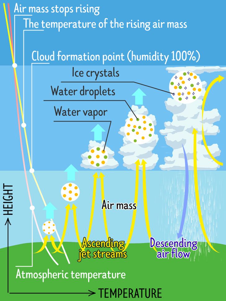
A cloud is a large group of tiny droplets of water or ice crystals (or both) floating in the air.
A cloud begins to be formed on the ground when the sunlight heats its surface. At the same time, the air mass next to it gets warmed up. Warm air becomes less dense and rises upward, and colder air takes its place. At high altitudes, the air cools down and condenses into water vapor. This is how a cloud appears. Some clouds are formed at higher altitudes, while others are formed at lower ones. This affects their shape and structure.
Clouds affect the weather a lot, which is why meteorologists always study their movement. In order to determine what a particular cloud is capable of, scientists have developed a system to classify the different types of clouds.
Types of clouds
The Latin-based international system for classifying clouds was introduced in 1803 by meteorologist Luc Howard. Later it was adapted by the World Meteorological Organization which recognized 10 basic cloud types. They are based on the height a cloud forms in the sky and its appearance.
According to this classification, all clouds can be divided into the following types:
- Cirrus
- Cirrostratus
- Cirrocumulus
- Altocumulus
- Altostratus
- Nimbostratus
- Cumulus
- Stratus
- Stratocumulus
- Cumulonimbus
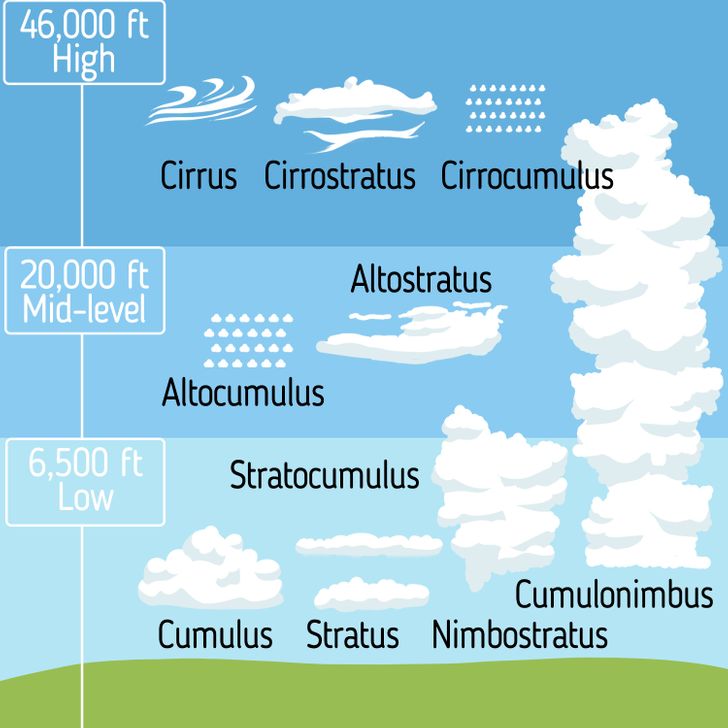
Depending on the height at which the clouds are located in the sky, they can be divided into 4 main types.
- Low-level clouds (Cumulus, Stratocumulus, Stratus) that lie below 6,500 feet
- Mid-level clouds (Altocumulus, Nimbostratus, Altostratus) that form between 6,500 and 20,000 feet
- High-level clouds (Cirrus, Cirrocumulus, Cirrostratus) that form above 20,000 feet
- Cumulonimbus clouds are multi-level and tower across the low, middle, and upper atmosphere.
Cumulus
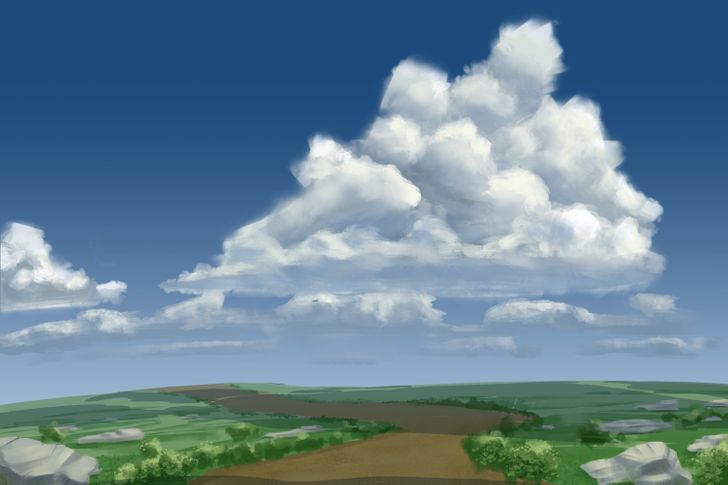
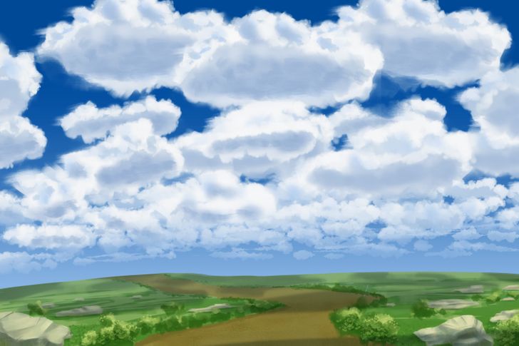
Cumulus clouds are the most recognizable of all. They have a well-defined rounded edge and resemble large mountains of fluffy cotton towering against the blue sky. In sunlight, these clouds look pure white, and during sunset, they can take on the most bizarre shades and shapes.
Cumulus clouds appear on clear sunny days and promise good weather.
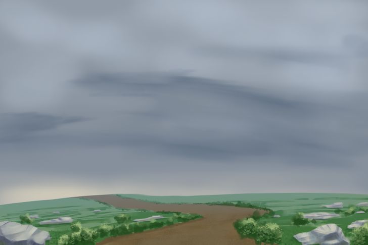
Stratus
Stratocumulus
Stratocumulus clouds resemble an old cotton blanket, in which the fibers have lost their elasticity and are slightly stretched out. They look thick and puffy, lie quite low, and have a whitish-gray tint that can vary from the base to the upper part. Such clouds usually cover the sky unevenly, as if leaving holes in it.
Stratocumulus clouds often form on cloudy days when there is a weak air current in the atmosphere and may be the sign of an upcoming storm.
Altocumulus
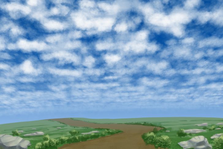
Altocumulus clouds are the most common type of mid-level clouds. They look like white-gray rounded spots, and resemble the wool of lambs. In the sky, they usually appear in groups or parallel stripes, which is why they are sometimes called “social clouds.”
These clouds form at a fairly low altitude, so they are mainly made of small water droplets. They can appear in the sky together with other types of clouds.
Altocumulus clouds often appear in the sky on warm, humid mornings, signaling a thunderstorm to come in the afternoon. They can also appear before cold fronts and signal the onset of cooler temperatures.
How to distinguish altocumulus clouds from stratocumulus clouds?
Pay attention to the size of the segments of each cloud. To do this, raise your hand toward the cloud. If the parts of the cloud are about the size of a thumb, then you have an Altocumulus cloud in front of you. If they are more of a size of a fist, then the clouds are Stratocumulus.
Altostratus
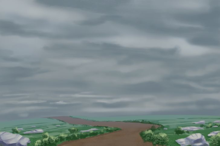
Altostratus clouds are quite featureless. They have a gray or bluish-gray color and, when they appear, they cover the entire sky evenly and rather densely. These clouds consist of water droplets and ice crystals that are thin enough to allow sun rays to pass through.
Altostratus clouds usually signal a warm front, prolonged rainy weather, or snowfall.
Nimbostratus
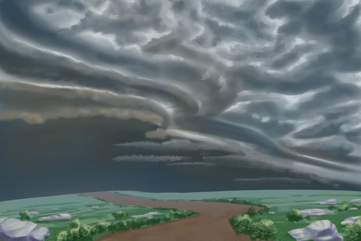
The Latin name for this cloud type derives from 2 words: “nimbus,” which means “rain” and “stratus” for “spread out.” These clouds form thick and dark layers in the sky that can block the sun.
Nimbostratus clouds form as a result of the accumulation of moisture in the atmosphere, therefore, they are associated with cloudy weather with prolonged rain or snow.
Cirrus
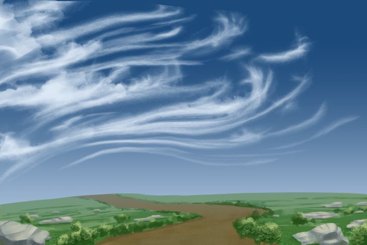
From Latin, the name of these clouds is translated as “curl of hair.” They look like translucent and almost weightless strands through which the blue sky can be seen. Cirrus clouds can appear earlier than other clouds, even before sunrise, and they can also remain in the sky after sunset. They are usually white in color, but can have a reddish-yellow tint at sunset, and become grayish after sunset.
Cirrus clouds usually appear in fair weather and signal an imminent change in it. They can also form ahead of a warm front or a severe storm.
Cirrocumulus
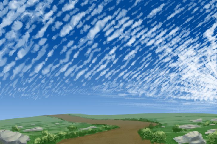
Cirrocumulus clouds are something in between cirrus and cirrostratus. They are small, curly, and resemble ripples in the clear sky. Cirrocumulus clouds are often arranged in rows. They form at high altitudes and are made of ice crystals.
Cirrocumulus clouds are sometimes called “mackerel skies” because they can be grayish in color and thus resemble fish scales.
These clouds are rare and short-lived. They can be seen in clear and sunny but cold weather (for example, in winter). In tropical regions, they can indicate an impending hurricane.
Cirrostratus

Cirrostratus clouds are like a thin and airy blanket that covers the entire sky. They are quite translucent, have a white or light gray color. With these clouds in the sky, the sun or moon acquires a beautiful glowing halo. This is due to the refraction of light reflected from the ice crystals that make up the clouds.
Cirrostratus clouds indicate that a large amount of moisture has accumulated in the upper atmosphere. Their sight often means rainfall in the next 24 hours. They also appear in the sky as warm fronts approach.
Cumulonimbus
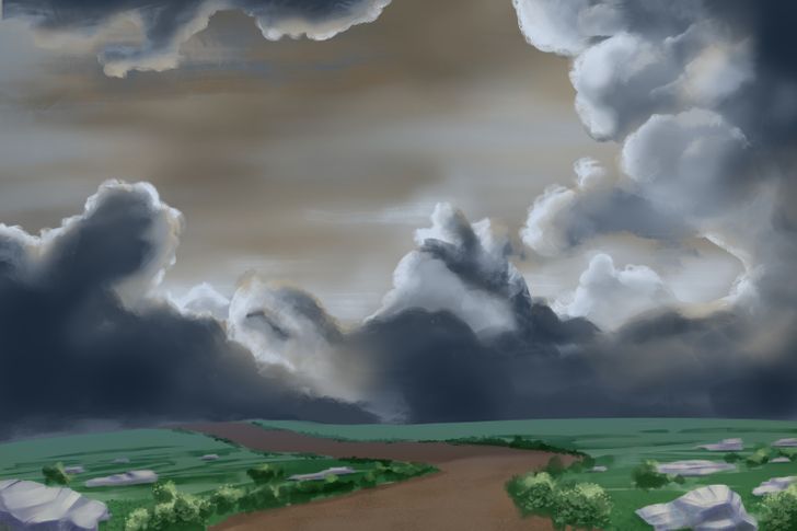
Cumulonimbus clouds, also known as thunderstorm clouds, are one of the few clouds that span all layers of the atmosphere. They look like huge cumulus clouds with a dark and muddy bottom and can spread out for several miles and reach enormous heights. The lower layer of this cloud mainly consists of water droplets, and the upper one is made of ice crystals.
Cumulonimbus clouds appear on hot days and signal a thunderstorm. In some areas, they can form before floods or tornadoes.